Ishrak Mohammad

CLOUD & DATA INFRASTRUCTURE — AZURE · GCP · GIS · ML

Certified Azure Administrator with three years across cloud IAM, data pipelines, and geospatial analytics — turning enterprise back-end platforms and public data sets into systems people can rely on.

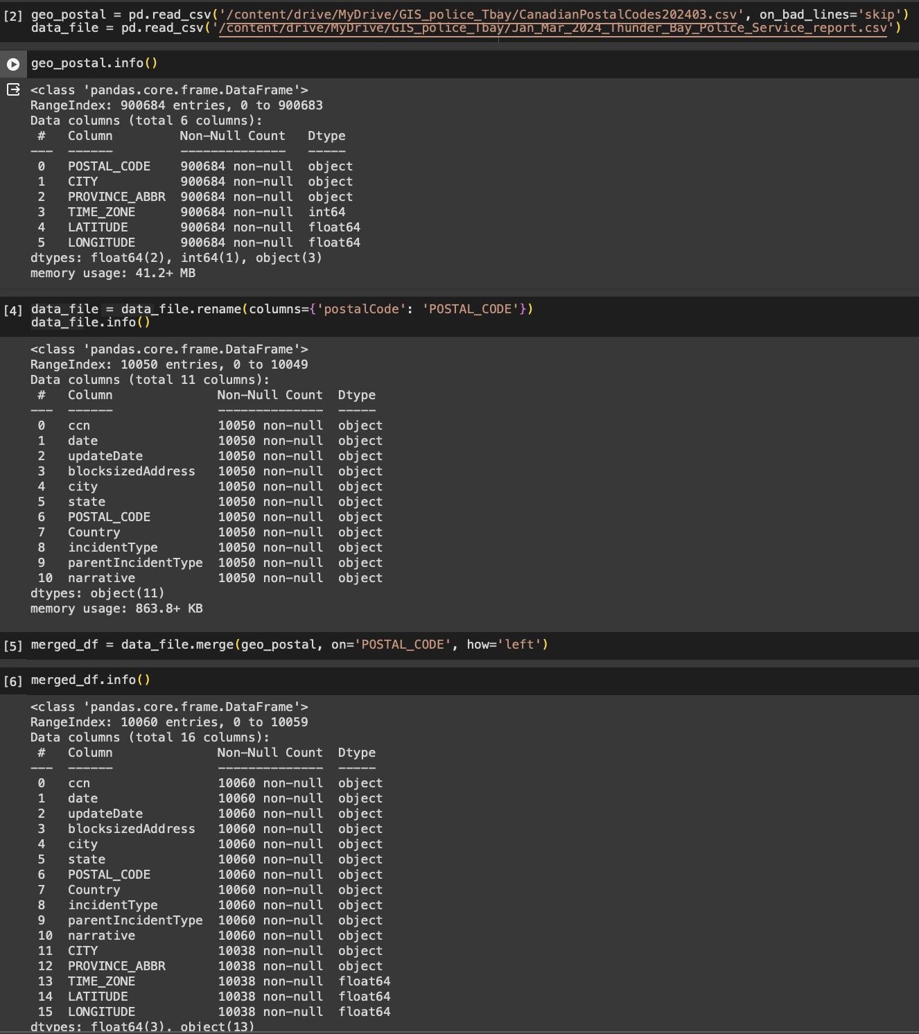
Portrait of Ishrak Mohammad outdoors in Waterloo, Ontario
WATERLOO, ON
About

I'm a cloud administrator and data engineer based in Waterloo, Ontario, working across Azure and Google Cloud to build and secure enterprise-scale infrastructure. My background spans IAM and network administration, data warehousing and pipelines, and — going back to my time at a geographic information services centre in Dhaka — GIS and spatial data visualization.

Most recently I supported a disability insurance claims portal at Manulife across four cloud back-end platforms, and before that engineered network and reporting solutions for 130+ remote staff and a regional tourism board. I like projects where infrastructure, data, and a clear map of the problem all come together.

  • LocationWaterloo, Ontario, Canada
  • Work StatusPermanent Resident, Canada
  • DrivingOntario G Licence, Own vehicle
  • EducationM.Sc. Computer Science, Lakehead University
  • CertifiedMicrosoft Azure Administrator Associate
  • FocusCloud IAM · Data Engineering · GIS · Finance Oparation
Experience

Where I've built things

MAY 2024 — APR 2026
Systems Installation Administrator
Manulife · Canada
  • Collaborated on a Disability Insurance Claim online portal spanning four cloud back-end platforms, improving accessibility and user experience.
  • Built advanced SQL and Excel workflows for mass data retrieval, cutting project delivery time by 20%.
  • Architected a centralized JIRA workflow across three geographically dispersed teams, speeding up issue resolution by 40%.
  • Implemented finance-grade secure data retrieval on Azure for a customer-facing dashboard, reducing estimated cyberattack/spam exposure by over 25%.
MAY 2022 — OCT 2022
IT Intern
Regional Tourism Organization 7 · Remote
  • Analyzed sales, revenue, and customer demand data from 500+ company profiles to generate BI reports on tourism revenue drivers.
  • Built interactive dashboards in Excel and Tableau for a six-person team's decision-making.
  • Presented findings to 500+ attendees at the 2022 Canadian Council for Small Business & Entrepreneurship conference.
MAY 2019 — MAR 2021
Systems Analyst
Center for Environmental and Geographic Information Services (CEGIS) · Dhaka
  • Built three .NET/IIS/MVC web applications under agile practices.
  • Developed JavaScript/JSON front-end tooling and APIs (including AnyChart), lifting user engagement by 40%.
  • Migrated 70% of company data from Access to a hybrid SQL Server / cloud setup.
  • Engineered cloud-based network solutions for 130 remote staff, cutting ticket resolution time by 25%.
  • Managed geospatial data and visualization with GeoJSON and Leaflet.
Skills

Toolkit

Cloud & IAM Administration

  • Azure Entra ID
  • Active Directory
  • VM Management
  • Network Security
  • Role Management
  • Backup & DR
  • Automation & Monitoring
  • LAN/WAN Routing

Data Engineering

  • Azure Databricks
  • Synapse
  • Data Factory
  • BigQuery
  • ETL
  • Hadoop
  • Apache Beam
  • Airflow
  • Spark
  • MySQL
  • Oracle DBA
  • AWS RDS / EC2

Machine Learning

  • Python
  • Neural Networks
  • Scikit-learn
  • NumPy
  • Pandas
  • JupyterLab / Colab

Web & API Development

  • JavaScript
  • React.js
  • Node.js
  • Express.js
  • Bootstrap
  • Material UI
  • AnyChart
  • JSON
Featured Project

Thunder Bay crime & collision mapping

GIS · Public Data · ArcGIS Online

Merging police incident data with geo-coordinates to map crime and collision patterns

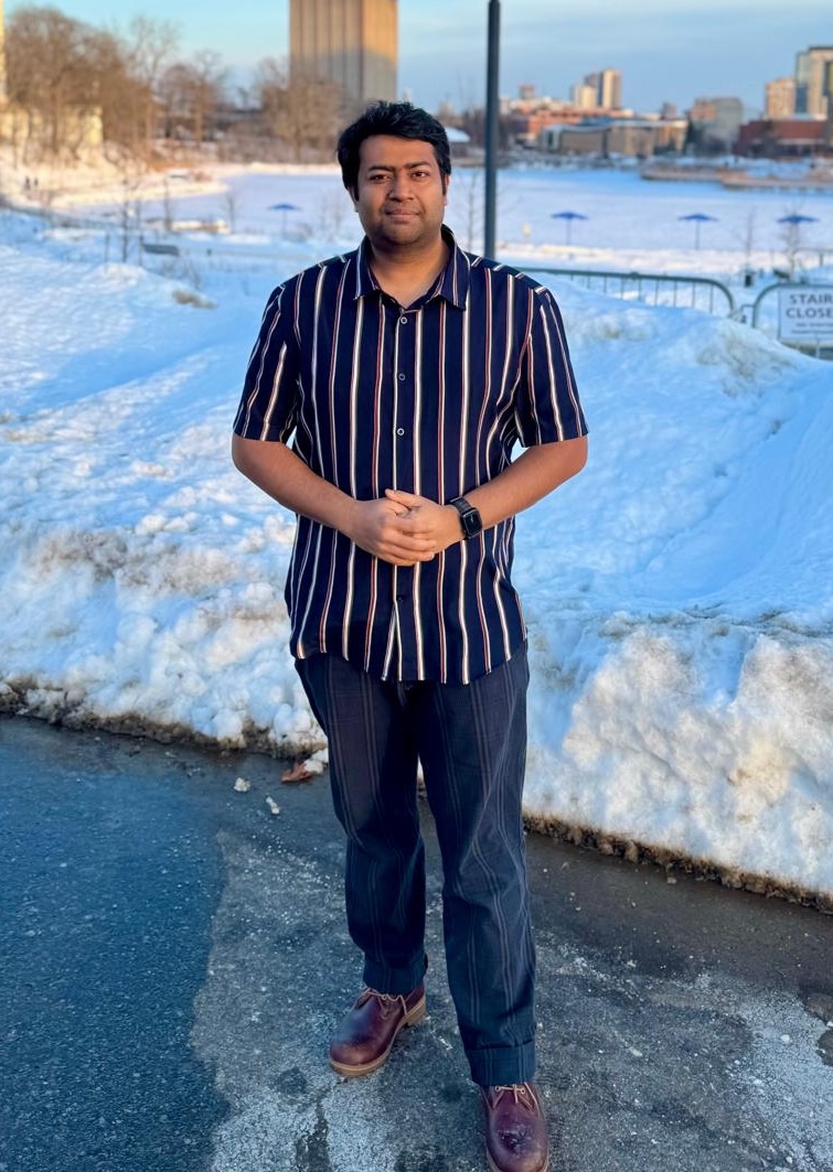
A self-directed GIS project using public incident data from the Thunder Bay Police Service (January–March 2024). I merged the incident report table with a Canadian postal-code geo-coordinate table in Python/pandas, then built two visualizations in ArcGIS Online.
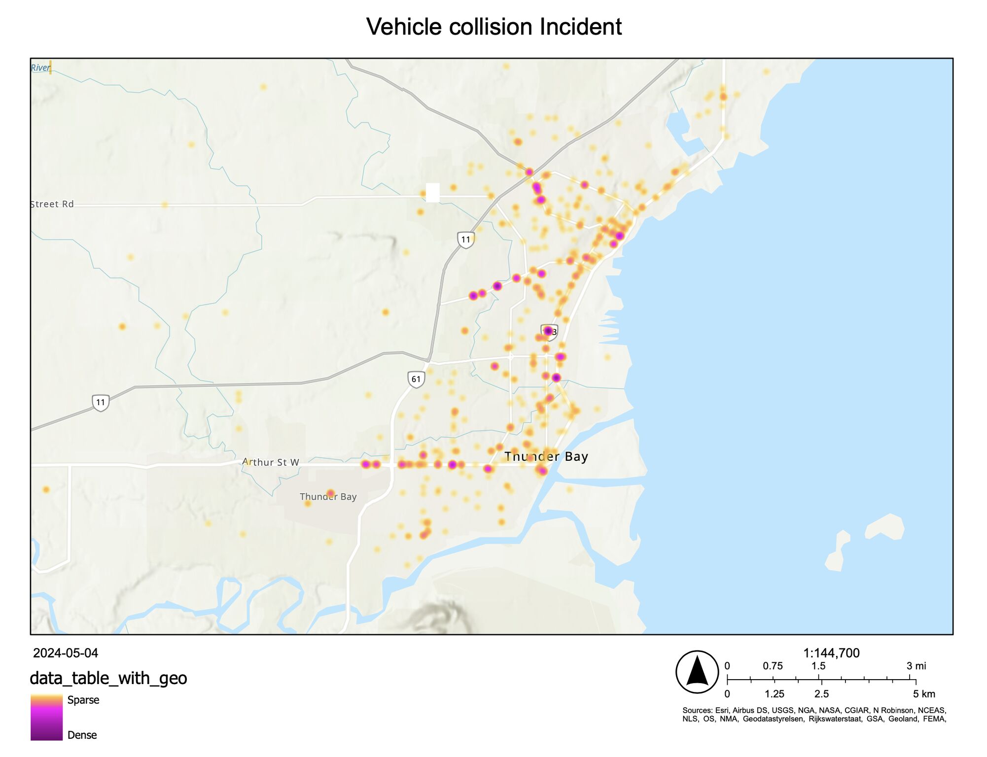
Heat map of vehicle collision incidents across Thunder Bay
Vehicle collision incidents — heat map
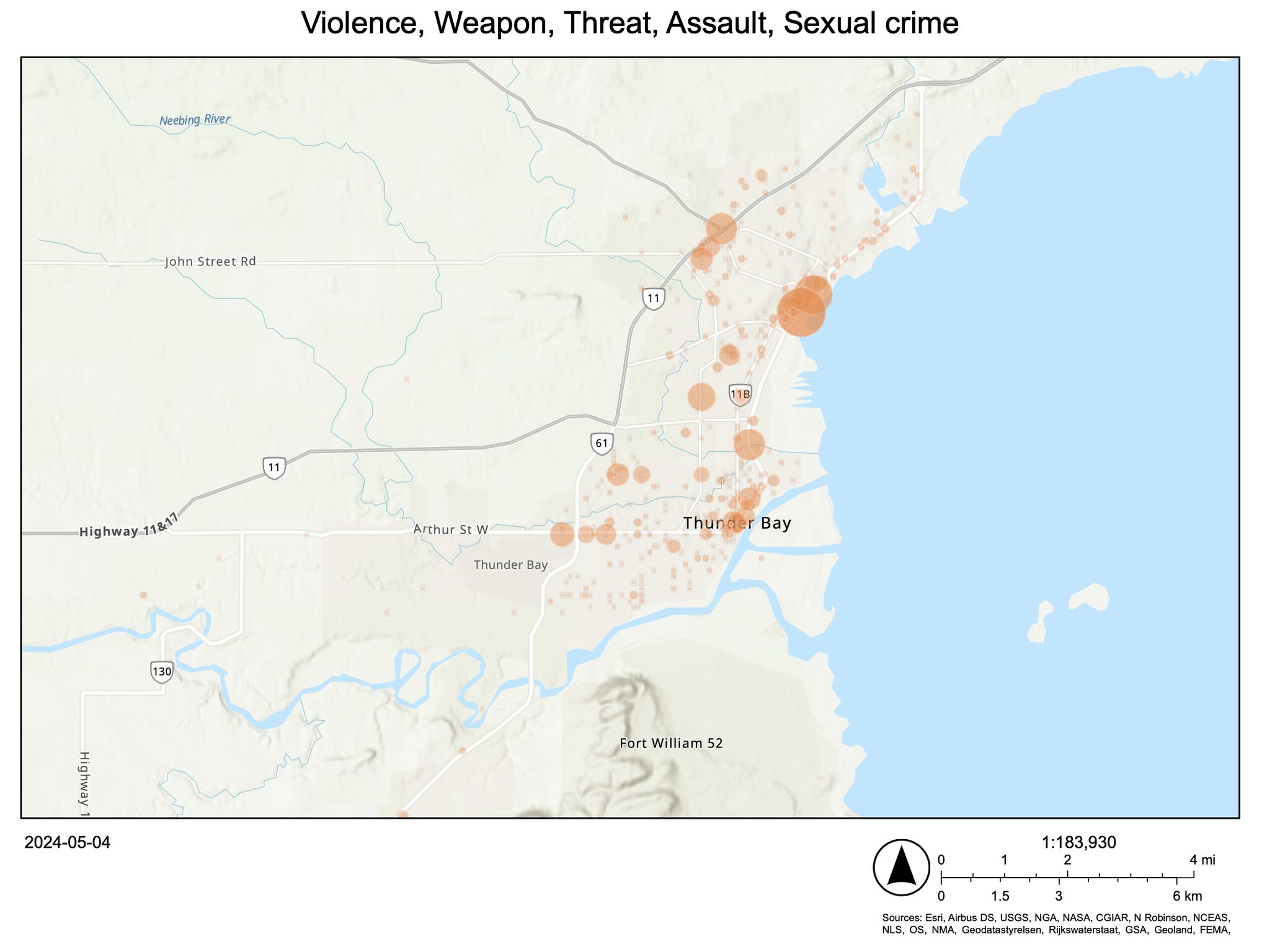
Aggregated map of violence, weapon, threat, assault, and sexual crime incidents across Thunder Bay
Violence / weapon / threat / assault / sexual crime — aggregated

The first map is a density heat map of vehicle collisions; the second aggregates violent, weapon, threat, assault, and sexual-crime incidents by location. Below is the pandas merge step joining the incident table to the geo-coordinate table on postal code.

Python pandas notebook merging the incident data with geo-coordinate data on postal code
No personally identifiable data was used or shown. Built for study purposes only — the maps do not represent demographic conclusions.
Certifications

Credentials

Microsoft Certified: Azure Administrator Associate certificate

Microsoft Certified: Azure Administrator Associate

Microsoft — Earned February 9, 2024
CREDENTIAL ID: 1583BA5F4E9E760
CERT NUMBER: BDE845-DF392D
LinkedIn Learning Power BI Essential Training certificate

Power BI Essential Training

LinkedIn Learning — Completed March 4, 2025
CPE CREDIT: 7.40
FIELD OF STUDY: Information Technology
Education
M.Sc. Computer Science
Lakehead University · Thunder Bay, ON — Scholarship recipient; built ML, cloud computing (AWS), and deep learning projects
MAY 2023
GIS Analysis Training
University of Dhaka — Spatial data analysis, decision-making, and resource optimization
2019